When evaluating environmental progress, you have to look at how the data is actually collected. As Alberta continues to move toward risk-based reclamation, the methods we use to monitor and document site recovery must evolve alongside the regulations.
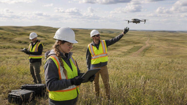
Recently, GCL’s Katie Allison presented at the CLRA conference on exactly this shift: detailing how we are integrating drone technology to support Detailed Site Assessments (DSAs) in southern Alberta.
Here is what that evolution looks like in practice.
What This Approach Actually Means
This is not about replacing boots on the ground with technology. It is about deploying a hybrid approach that maximizes both.
- Landowner Respect & Access: In areas where land access is limited or landowners prefer that field crews minimize entry onto their property, UAV imagery allows us to collect highly accurate visual data without causing disruption. It maintains strong landowner relationships while keeping the project moving forward.
- Targeted Field Verification: Drone technology supplements our traditional assessments. By gathering high-resolution spatial data first, our field teams know exactly where to focus their verification efforts, drastically improving efficiency in challenging terrain.
What’s Behind the Approach
Innovation of this kind requires alignment across the entire industry.
- Regulatory Collaboration: This work is actively evolving. We are working closely with regulators, operators, and academic partners to ensure our vegetation data and documentation standards completely align with AER expectations for reclamation certification.
- The GCL Focus: We don’t adopt technology just for the sake of it. We adopt it when it proves it can reduce friction, increase safety, and build a more defensible data set for our clients and the regulator.
Vision: Smarter Site Assessment
Our vision is to build the most efficient, results-oriented path to site closure. Integrating UAV data into our workflow is what that looks like on the ground. It means safer crews, happier landowners, and faster regulatory consensus.
What’s Next:
The project in southern Alberta—focused on pipeline overview assessments—is just the beginning. The next step is exploring pilot opportunities and expanding this UAV approach to other disturbance types, including roads, seismic lines, and broader restoration programs across the province.